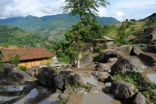
Xin Man, Ha Giang: What Makes This Region Special?
Xin Man district has a complex terrain, located in the upper Chay River mountain range, so it is mainly hills with steep slopes and divided by many streams.
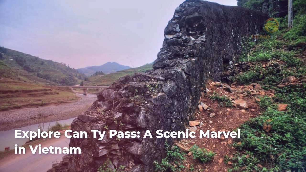
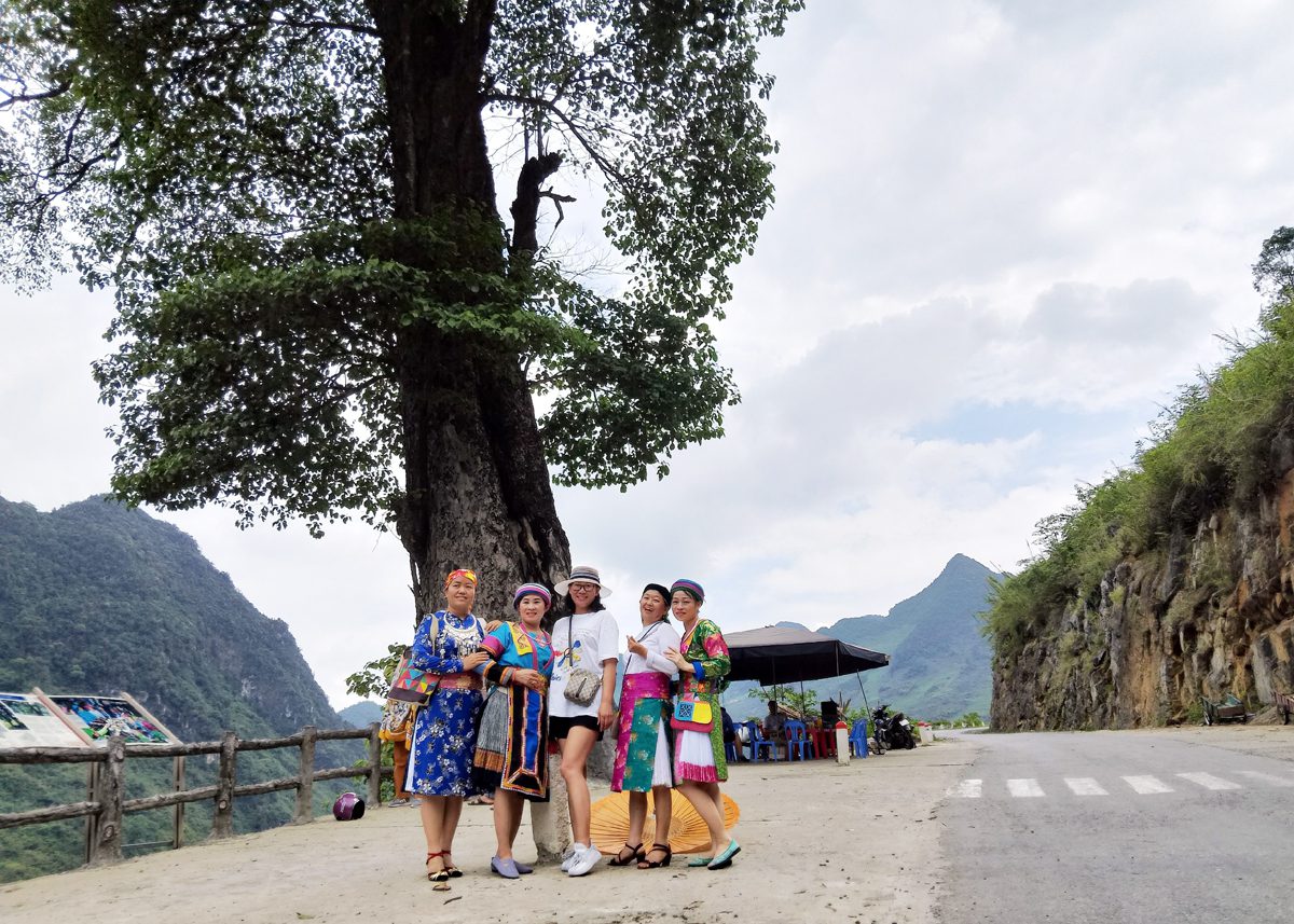
The Mien-Can Ty River Canyon Heritage Cluster may be found in the communal area of Can Ty, which is situated within the Quan Ba District of Ha Giang Province. In Mong language, the word “Can” means “dry,” and the word “Ty” means “land,” which refers to a stretch of dry land. Lung Vai, Sua Can Ty, San Can Ty, Po Chua Lung, and Sin Suoi Ho are some of the villages that are included in the Can Ty Commune. Most of the people in this area are Mong, but some are Dao.
When the dry season arrives, this region frequently does not have enough water for production and daily life. Corn is the most important crop in this region, accounting for eighty percent of the total, along with rice and a few other crops.
Between Quan Ba and Yen Minh, the Mien—Can Ty River Canyon Heritage Cluster can be found running along both sides of National Highway 2C throughout its entirety. Visitors have the opportunity to take in the splendor of natural and geological heritage that is typical of this area, such as the Mien River Canyon, the Can Ty fault wall, the Can Ty accumulation platform, and the historic Nghien Wood Forest.
The Mien River Gorge may be found in the Can Ty commune, specifically in the settlements of Dau Cau 1 and Dau Cau 2. The gorge, which is approximately one kilometer in length, was produced by the Neo-Tectonic fault as well as the erosion caused by the Mien River. Sub-meridional tectonic fault walls can be seen on both sides of the gorge. Additionally, there are hanging valley mouths on the top of the wall, and old landslide accumulation slopes may be found at the base of the wall.
The Can Ty fault wall is actually a remnant of the activity that occurred in the Mien River fault zone. It has a sub-meridional direction that divides the limestone formations of the Bac Son system, which results in the construction of the “Mien River Gorge.” As a result of the destructive action of the Neo-tectonic Mien River fault, which began approximately 500 million years ago and continues to the current day, steep limestone cliffs may be found on both sides of the Mien River.
Within the village of Sin Suoi Ho is where you will find the historic Nghien wood forest. Where the travertine accumulation terrace is located, the ancient Nghien wood forest can be found growing. Both the travertine terraces and the outlet site of the karst source are great clues that indicate the location of the source. At this point, the stream flows at an angle of 120 degrees, coming down from the cliff and down towards the Mien River. Seven of the nghien trees are rather enormous, and there are also a huge number of smaller nghien trees flourishing throughout the forest.
The findings of another project on biodiversity indicate that the nghien trees in this area are red nghien, and the oldest tree is around 250 years old. Another project was conducted to investigate biodiversity. Limestone belonging to the Khao Loc formation characterizes the rock formation at the survey site. Sub-latitude faults have carved through the limestone, resulting in the creation of calcareous zones.
An appealing tourist attraction with magnificent, typical scenery, the Mien—Can Ty river canyon cluster is a combination of excellent heritage elements and a cluster of river canyons. The ethnic and cultural identity of this region is still relatively unaltered, which is a positive aspect of this region. When visiting the Dong Van Stone Plateau, tourists should make sure to take the time to explore the area and think about their experiences.
Xin Man district has a complex terrain, located in the upper Chay River mountain range, so it is mainly hills with steep slopes and divided by many streams.
Venture into the untamed beauty of northern Vietnam with Vietnam Treasure and discover the magic of Suoi Thau Steppe. This captivating landscape offers a unique blend of cultural immersion and breathtaking natural scenery far from the bustling tourist trails.
Nestled high in the mountainous region of Ha Giang, Phung Village (Ban Phung) is a hidden gem offering a glimpse into the authentic beauty and culture of Northern Vietnam.
Stop at Thong Nguyen Village, and you will discover amazing beauty. This is a rugged and difficult mountainous area. Many people may think that nothing is interesting here. Join Vietnam Treasure to discover the beauty of Thong Nguyen Village.

Its name, Hoàng Su Phì or Hoàng Thụ Bì, means “the yellow bark” in the Hmong language. It indicates the woods of weeping cypress, which is a local specialty.

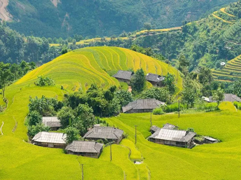
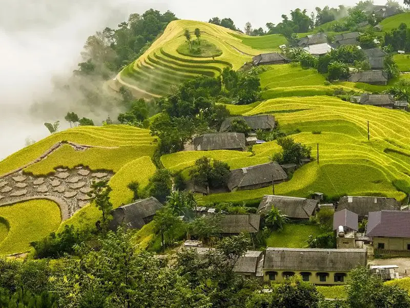
Hoang Su Phi terraced fields possess an undeniable charm, creating a mesmerizing scene—journey to Ha Giang with Vietnam Treasure to witness the brilliant golden rice harvest season. Although present in many countries, especially in Southeast Asia, terraced fields in Vietnam are deeply associated with the traditional agricultural activities of many ethnic groups in the northern mountainous region, such as the H’Mong, Dao, Nung, La Chi and Ha Nhi.

Tu San Canyon (Mèo Vạc district), the deepest canyon in Vietnam. It has a depth of about 800 m, a length of 1.7 km, and cliffs that slope 70° to 90°.
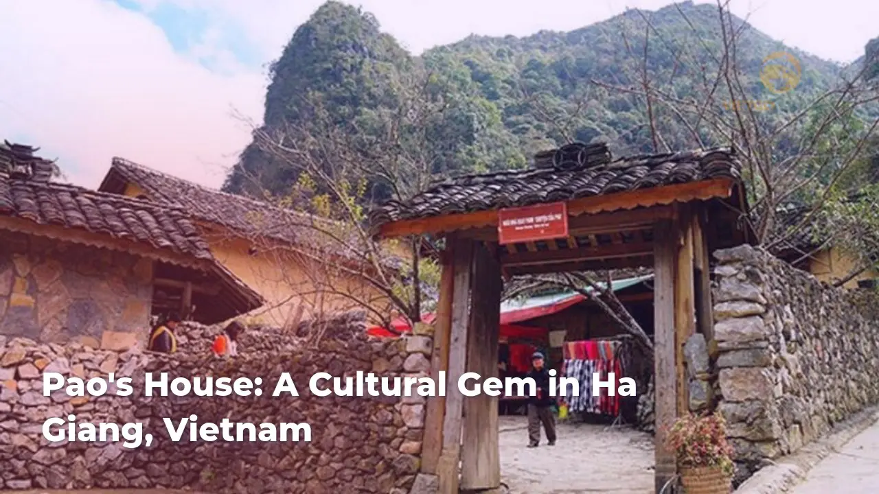
Discover the charm of Pao’s House, Ha Giang. Dive into local culture and scenic beauty. Plan your adventure now!
Copyrights @2025 Vietgo Travels. Terms and Conditions Privacy Policy
Hotline
+84 855 452 888 (Viet Nam) / +1 (206) 665 3090 (US)
Email: [email protected]
Website: www.vietgotravels.com
Head Office:
No. 23 Lo Su Street, Hoan Kiem District, Ha Noi, Viet Nam.
Viet Nam’s branch:
No. 35 Hang Quat Street, Hoan Kiem District,
Ha Noi, Viet Nam.
US:
831 41st Pl, Everett, WA 98201, USA